Traffic Flow · Engineering
See the whole corridor from above.
Overhead aerial documentation of intersections, corridors, and interchanges for traffic engineers, municipalities, and DOTs — the elevated vantage the ground can't give you, in 4K. Based in Cleveland, flying corridors across all of Ohio — plus the Buffalo, Pittsburgh, and Detroit areas and beyond. FAA Part 107 certified and $1,000,000 insured.
Cleared to fly the corridor
What a municipality or DOT needs before a vendor flies a public roadway.
- FAA
- Part 107 certified
- $1M
- Aviation liability insured
- 10,000+
- Flight hours
- 4K
- Delivery standard
Every flight is FAA Part 107 certified and carries $1,000,000 in aviation liability insurance. Where the airspace requires it, we secure FAA authorization in advance — and we'll provide a certificate of insurance on request.
What you get
Footage your engineers can actually work from.
An elevated, full-context vantage of the intersection or corridor — captured to a standard your team can review, measure, and present.
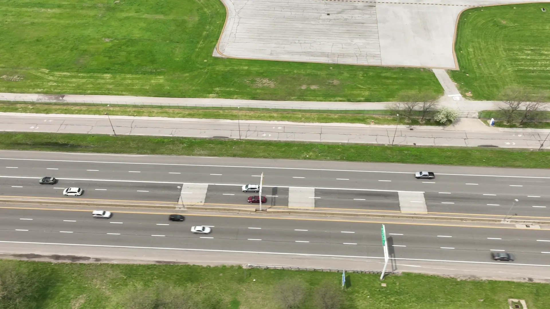
The whole corridor in one frame
4K overhead video and high-resolution stills of the full intersection, interchange, or corridor — the perspective the ground simply can't provide.
Cleared to fly public roadways
FAA Part 107 certified and $1,000,000 insured, with authorizations handled in advance and a certificate of insurance on request.
Captured when your study needs it
Scheduled to peak, off-peak, or before-and-after a project — footage your team uses for turning-movement counts, queue and gap analysis, and signal-timing review.
Persuasive in the room
An aerial that residents and officials instantly understand at the public meeting — far more than a plan sheet.
Traffic & infrastructure FAQ
What engineers and municipalities ask first.
Are you certified and insured to fly over a public roadway?
Yes. Every flight is flown by an FAA Part 107 certified pilot and carries $1,000,000 in aviation liability insurance. Where the airspace requires it, we secure FAA authorization in advance, and we'll provide a certificate of insurance on request.
Can you capture specific times — peak hours, a specific day?
Yes. We schedule flights to the exact window your study calls for — AM/PM peak, off-peak, weekday or weekend — and return for repeat captures as needed.
Can you cover a whole corridor, not just one intersection?
Yes. We document full corridors and interchanges from altitude, so you see how the whole system moves — not just a single point.
What format do we get the data in?
Clean 4K aerial video and high-resolution stills. Your team uses that footage for turning-movement counts, queue and gap analysis, signal-timing review, and exhibits.
Do you work outside the Cleveland area?
Yes — all of Ohio and beyond, including the Buffalo, Pittsburgh, and Detroit areas, and we travel for projects further out. Tell us the location and we'll handle the logistics and authorizations.
Get the elevated view
Have a study or corridor coming up? Let's get it scheduled.
Tell us the location, the study, and the times you need captured — we'll come back with a plan, usually the same business day.